Geolocate

Mount Forest topographic map

Click on the map to display elevation.

About this map
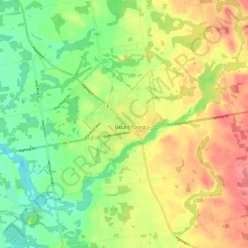
Name: Mount Forest topographic map, elevation, terrain.

Location: Mount Forest, Wellington North, Wellington County, Ontario, N0G 2L3, Canada (43.94070 -80.77382 44.02070 -80.69382)

Average elevation: 417 m

Minimum elevation: 380 m

Maximum elevation: 456 m

Other topographic maps

Click on a map to view its topography, its elevation and its terrain.

Gear up for your next adventure:

🧥Packable Down Jackets - Lightweight warmth that compresses small in your bag
🧭Emergency Beacons - Safety beacons for remote outdoor locations
🧴Sport Sunscreen Sticks - High-protection sunblock that won't run into your eyes on the trail
🗺️Scratch-off Peak Maps - Track your progress climbing Munros or Wainwrights
🧥Softshell Jackets - Breathable jackets for active outdoor use

As an Amazon Associate, this site earns from qualifying purchases at no extra cost to you.