Geolocate

Neu-Ulm topographic map

Click on the map to display elevation.

About this map
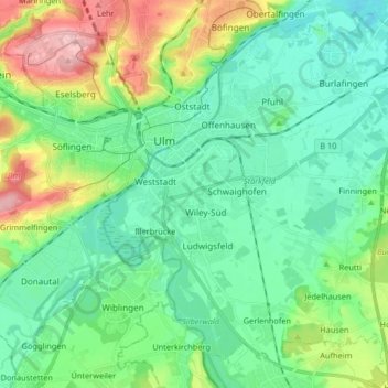
Name: Neu-Ulm topographic map, elevation, terrain.

Location: Neu-Ulm, Landkreis Neu-Ulm, Bavaria, Germany (48.33103 9.96743 48.43350 10.13160)

Average elevation: 499 m

Minimum elevation: 451 m

Maximum elevation: 626 m

Other topographic maps

Click on a map to view its topography, its elevation and its terrain.
Wullenstetten

Germany > Bavaria > Landkreis Neu-Ulm > Senden

Average elevation: 504 m

Gear up for your next adventure:

🔭Compact Hiking Binoculars - Lightweight optics for scouting terrain and spotting wildlife
🔦Waterproof LED Headlamps - Hands-free lighting for evening treks and emergency navigation
🐕Hiking Dog Harnesses - Rugged harnesses for taking your companion on mountain trails
📚UK Hiking Guidebooks - Detailed route descriptions for the Lake District, Peaks, and Highlands
🍲Portable Camping Stoves - Fast-boiling stoves for hot meals on remote topographic survey trips

As an Amazon Associate, this site earns from qualifying purchases at no extra cost to you.