
Folke topographic map
Interactive map
Click on the map to display elevation.
About this map
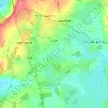
Name: Folke topographic map, elevation, terrain.
Location: Folke, Dorset, South West England, England, United Kingdom (50.89116 -2.49916 50.93500 -2.45371)
Average elevation: 88 m
Minimum elevation: 62 m
Maximum elevation: 138 m