
Fothergill Island topographic map
Interactive map
Click on the map to display elevation.
About this map
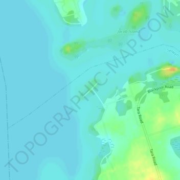
Name: Fothergill Island topographic map, elevation, terrain.
Average elevation: 248 m
Minimum elevation: 243 m
Maximum elevation: 273 m
Other topographic maps
Click on a map to view its topography, its elevation and its terrain.
Lakefield
Canada > Ontario > Peterborough County > Selwyn
Lakefield, Selwyn, Peterborough County, Central Ontario, Ontario, K0L 2H0, Canada
Average elevation: 248 m
Buckhorn Lake
Canada > Ontario > Peterborough County > Selwyn
Buckhorn Lake, Selwyn, Peterborough County, Central Ontario, Ontario, Canada
Average elevation: 259 m
Bridgenorth
Canada > Ontario > Peterborough County > Selwyn
Bridgenorth, Selwyn, Peterborough County, Central Ontario, Ontario, K9J 6X2, Canada
Average elevation: 262 m