
Saoula topographic map
Interactive map
Click on the map to display elevation.
About this map
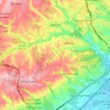
Name: Saoula topographic map, elevation, terrain.
Location: Saoula, Bir Mourad Rais District, Algiers, Algeria (36.65716 3.00447 36.71587 3.07732)
Average elevation: 113 m
Minimum elevation: 19 m
Maximum elevation: 208 m