Geolocate

Joshua topographic map

Click on the map to display elevation.

About this map
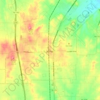
Name: Joshua topographic map, elevation, terrain.

Location: Joshua, Johnson County, Texas, United States (32.43271 -97.46380 32.49180 -97.36012)

Average elevation: 269 m

Minimum elevation: 225 m

Maximum elevation: 315 m

Other topographic maps

Click on a map to view its topography, its elevation and its terrain.

Highland

United States > Texas > Johnson County

Average elevation: 198 m

Turkey Peak

United States > Texas > Johnson County > Burleson

Average elevation: 237 m

Oak Hill

United States > Texas > Johnson County > Cleburne

Average elevation: 240 m

Gear up for your next adventure:

🔦LED Camping Lanterns - Illumination for reading maps inside your tent at night
🎒Hiking Daypacks (20L) - Compact backpacks for day trips and technical mountain ascents
🧣Neck Gaiters - Versatile protection against wind and cold
📻Hand-Crank Emergency Radios - Stay updated on weather warnings in remote areas
🧊Personal Water Filters - Drink safely from mountain streams marked on your map

As an Amazon Associate, this site earns from qualifying purchases at no extra cost to you.