
Bryson topographic map
Interactive map
Click on the map to display elevation.
About this map
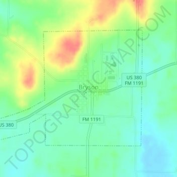
Name: Bryson topographic map, elevation, terrain.
Location: Bryson, Jack County, Texas, 76427, United States (33.15280 -98.40764 33.17070 -98.37661)
Average elevation: 382 m
Minimum elevation: 361 m
Maximum elevation: 419 m
Other topographic maps
Click on a map to view its topography, its elevation and its terrain.
Jack County
United States > Texas > Jack County
Jack County, Texas, United States
Average elevation: 334 m