
Bass Lake topographic map
Interactive map
Click on the map to display elevation.
About this map
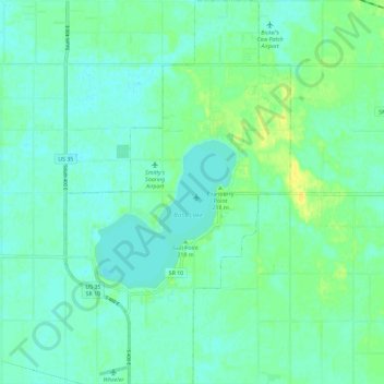
Name: Bass Lake topographic map, elevation, terrain.
Location: Bass Lake, Starke County, Indiana, 45534, United States (41.18646 -86.62120 41.27355 -86.55329)
Average elevation: 220 m
Minimum elevation: 214 m
Maximum elevation: 233 m