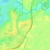
Busselton topographic map
Click on the map to display elevation.
About this map

Name: Busselton topographic map, elevation, terrain.
Location: Busselton, Western Australia, Australia (-33.80450 115.18888 -33.48450 115.50888)
Average elevation: 23 m
Minimum elevation: 0 m
Maximum elevation: 199 m
Other topographic maps
Click on a map to view its topography, its elevation and its terrain.
















Rockingham
Rockingham is topographically flat, has sandy soils and coastal vegetation. It has a northern aspect to Cockburn Sound, from Rockingham Beach and Palm Beach.
Average elevation: 4 m


Upper Swan
Topographically, most of Upper Swan is low-lying, sitting at an average of 20 metres above sea level within the flood plains of the Swan River. This drops further to only 11 metres immediately around the banks of the river. An exception is the area of the Darling Scarp, where Mount Mambup reaches a peak of 224…
Average elevation: 35 m



Stirling Range National Park
The park is particularly rich in banksias, eucalypts, orchids and verticordias. Ten species of mountain bells (Darwinia spp.) have been identified in the park and only one of these is found outside Stirling Range. Five major vegetation communities are known in the park with thicket and mallee-heath at higher…
Average elevation: 235 m