
Masseyville topographic map
Interactive map
Click on the map to display elevation.
About this map
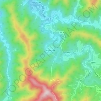
Name: Masseyville topographic map, elevation, terrain.
Average elevation: 531 m
Minimum elevation: 386 m
Maximum elevation: 844 m
Other topographic maps
Click on a map to view its topography, its elevation and its terrain.
Pluto
United States > West Virginia > Raleigh County > Pluto
Pluto, Raleigh County, West Virginia, United States
Average elevation: 867 m
Beckley
United States > West Virginia > Raleigh County
Beckley, Raleigh County, West Virginia, 25801, United States
Average elevation: 723 m