
Phra Nakhon Si Ayutthaya Province topographic map
Interactive map
Click on the map to display elevation.
About this map
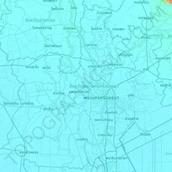
Name: Phra Nakhon Si Ayutthaya Province topographic map, elevation, terrain.
Location: Phra Nakhon Si Ayutthaya Province, Thailand (14.10745 100.21262 14.67851 100.82327)
Average elevation: 6 m
Minimum elevation: 0 m
Maximum elevation: 566 m
Other topographic maps
Click on a map to view its topography, its elevation and its terrain.
Lop Buri
Lopburi lies on the Lopburi River at an elevation of 20 metres (66 ft) mostly surrounded by alluvial plains, although some hills rise to between 300 metres (980 ft) and 600 metres (2,000 ft) to the north-east.
Average elevation: 12 m
Ban Khlong Bang Kaeo Yai
Thailand > Bang Phli Yai Subdistrict Administrative Organization > Bang Phli Yai Subdistrict
Average elevation: 3 m
Ban Bang Khamin
Thailand > Bang Yo Subdistrict Administrative Organization > Bang Yo Subdistrict
Average elevation: 5 m
Doi Inthanon
In 1954, the forests around Doi Inthanon were conserved, creating Doi Inthanon National Park, as one of the original 14 national parks of Thailand. This park now covers 482.4 km2 and spreads from the lowlands at 800 metres (2,625 ft) elevation up to the peak at 2,565 metres (8,415 ft). Given the varied…
Average elevation: 2,364 m
Prachuap Khiri Khan
Thailand > Mueang Prachuap Khiri Khan
Prachuap Khiri Khan covers an area totaling 6,367 square kilometers (2,458 sq mi). The province is on the Kra Isthmus, the narrow land bridge connecting the Malay Peninsula with mainland Asia. The province has one of the narrowest parts of Thailand, just 12.38 km (7.69 mi) from the Gulf of Thailand to the…
Average elevation: 9 m
Ban Bang Sao Thong
Thailand > Bang Sao Thong Subdistrict Administrative Organization > Bang Sao Thong Subdistrict
Average elevation: 4 m