
Straßkirchen topographic map
Interactive map
Click on the map to display elevation.
About this map
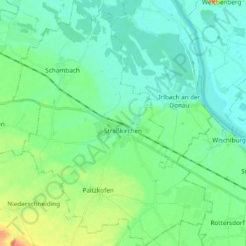
Name: Straßkirchen topographic map, elevation, terrain.
Average elevation: 327 m
Minimum elevation: 312 m
Maximum elevation: 380 m
Other topographic maps
Click on a map to view its topography, its elevation and its terrain.
Geiselhöring
Germany > Bavaria > Landkreis Straubing-Bogen
Geiselhöring, Landkreis Straubing-Bogen, Bavaria, 94333, Germany
Average elevation: 385 m