
Thank you for supporting this site ❤️
Make a donation
Make a donation
Gear up for your next adventure:
As an Amazon Associate, this site earns from qualifying purchases at no extra cost to you.
Halayhayin topographic map
Click on the map to display elevation.
Thank you for supporting this site ❤️
Make a donation
Make a donation
Gear up for your next adventure:
As an Amazon Associate, this site earns from qualifying purchases at no extra cost to you.
About this map
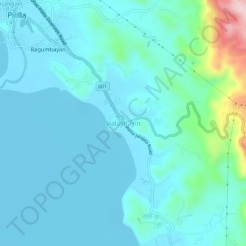
Name: Halayhayin topographic map, elevation, terrain.
Location: Halayhayin, Pililla, Rizal, Calabarzon, 1910, Philippines (14.44361 121.30550 14.48361 121.34550)
Average elevation: 39 m
Minimum elevation: 0 m
Maximum elevation: 280 m
Thank you for supporting this site ❤️
Make a donation
Make a donation
Gear up for your next adventure:
As an Amazon Associate, this site earns from qualifying purchases at no extra cost to you.