Geolocate

West Point topographic map

Click on the map to display elevation.

About this map
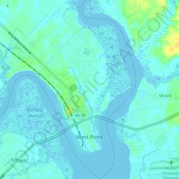
Name: West Point topographic map, elevation, terrain.

Location: West Point, King William County, Virginia, 23118, United States (37.51756 -76.83386 37.57723 -76.77688)

Average elevation: 4 m

Minimum elevation: -4 m

Maximum elevation: 24 m

Other topographic maps

Click on a map to view its topography, its elevation and its terrain.
Aylett

United States > Virginia > King William County

Average elevation: 19 m

Manquin

United States > Virginia > King William County

Average elevation: 27 m

Aylett

United States > Virginia > King William County

Average elevation: 19 m

Gear up for your next adventure:

🌦️Portable Weather Meters - Handheld tools for monitoring weather conditions
🎒Replacement Sternum Straps - Repair parts for hiking rucksacks
🧼Technical Clothing Wash - Special soap to clean and restore waterproof membranes
📍Handheld GPS Navigators - Reliable satellite navigation for hiking and off-road exploration
🥾Men's Waterproof Hiking Boots - Durable footwear with deep lugs for muddy and rocky UK terrains

As an Amazon Associate, this site earns from qualifying purchases at no extra cost to you.