Geolocate

Fehmarn topographic map

Click on the map to display elevation.

About this map
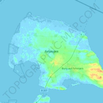
Name: Fehmarn topographic map, elevation, terrain.

Location: Fehmarn, Ostholstein, Schleswig-Holstein, 23769, Germany (54.40137 11.00454 54.53622 11.31286)

Average elevation: 2 m

Minimum elevation: -7 m

Maximum elevation: 26 m

Other topographic maps

Click on a map to view its topography, its elevation and its terrain.

Gear up for your next adventure:

🧣Neck Gaiters - Versatile protection against wind and cold
🧥Softshell Jackets - Breathable jackets for active outdoor use
🧗Locking Carabiners - Secure gear to your pack or for light technical use
🕶️Polarized Sunglasses - Reduces glare from snow and water when reading terrain
👟Heavy Duty Boot Laces - Always carry a spare for your hiking footwear

As an Amazon Associate, this site earns from qualifying purchases at no extra cost to you.