Geolocate

Tenterden topographic map

Click on the map to display elevation.

About this map
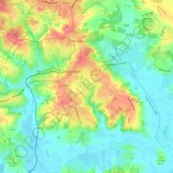
Name: Tenterden topographic map, elevation, terrain.

Location: Tenterden, Ashford, Kent, England, United Kingdom (51.02750 0.64253 51.09999 0.75704)

Average elevation: 28 m

Minimum elevation: -1 m

Maximum elevation: 78 m

Kent trails, hiking, mountain biking, running and outdoor activities

Gear up for your next adventure:

🧭GPS Trackers - Tracking devices for safety and navigation
📢Survival Whistles - Essential safety gear for signaling for help in mountain fog
🥤Hydration Bladders - Hands-free hydration systems for backpacks
⛺Camping Shelters - Emergency and lightweight shelters for outdoor use
📻Hand-Crank Emergency Radios - Stay updated on weather warnings in remote areas

As an Amazon Associate, this site earns from qualifying purchases at no extra cost to you.