Geolocate

Upper Boat topographic map

Click on the map to display elevation.

About this map
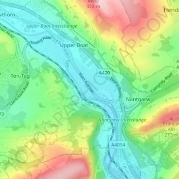
Name: Upper Boat topographic map, elevation, terrain.

Location: Upper Boat, Pontypridd, Rhondda Cynon Taf, Wales, CF37 5AJ, United Kingdom (51.55415 -3.30680 51.59415 -3.26680)

Average elevation: 131 m

Minimum elevation: 31 m

Maximum elevation: 322 m

Rhondda Cynon Taf trails, hiking, mountain biking, running and outdoor activities

Gear up for your next adventure:

🧺Mesh Stuff Sacks - Breathable storage for wet gear or camp organization
⌚Altimeter Watches - Watches measuring altitude for mountain activities
📷Camera Straps - Secure straps for carrying cameras while walking
🧴Tick Removal Tools - Small, essential health tool for UK woodland and moorland
📢Survival Whistles - Essential safety gear for signaling for help in mountain fog

As an Amazon Associate, this site earns from qualifying purchases at no extra cost to you.