Geolocate

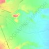
Chilecito topographic map

Click on the map to display elevation.

About this map

Name: Chilecito topographic map, elevation, terrain.

Location: Chilecito, Departamento Chilecito, La Rioja, F5360, Argentina (-29.18790 -67.54256 -29.13517 -67.48308)

Average elevation: 1,120 m

Minimum elevation: 997 m

Maximum elevation: 1,390 m

Other topographic maps

Click on a map to view its topography, its elevation and its terrain.

Laguna Brava

Argentina > La Rioja

Average elevation: 4,360 m

Las Pampas

Argentina > La Rioja

Average elevation: 643 m

La Rioja

Argentina > La Rioja

Average elevation: 777 m

Cerro El Bolsón

Argentina > La Rioja

Average elevation: 2,412 m

Loma Blanca

Argentina > La Rioja

Average elevation: 495 m

Gear up for your next adventure:

🔥Emergency Fire Starters - Reliable ignition tools for survival situations in damp conditions
⛺Lightweight Solo Tents - Backpacking tents designed for wild camping in the UK highlands
🧤Hiking Gloves - Warm and durable gloves for cold-weather walks
🌂Windproof Trekking Umbrellas - Surprising but effective rain protection on low-wind trails
🎒Backpack Rain Covers - Universal waterproof covers to protect your gear from downpours

As an Amazon Associate, this site earns from qualifying purchases at no extra cost to you.