Geolocate

Sitges topographic map

Click on the map to display elevation.

About this map
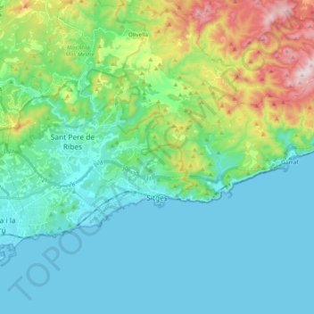
Name: Sitges topographic map, elevation, terrain.

Location: Sitges, Garraf, Barcelona, Catalonia, Spain (41.21859 1.75620 41.29134 1.94493)

Average elevation: 131 m

Minimum elevation: -1 m

Maximum elevation: 592 m

Other topographic maps

Click on a map to view its topography, its elevation and its terrain.
Gear up for your next adventure:

🛰️Outdoor GPS Navigation - Navigation devices for remote and off-grid areas
🗺️Ordnance Survey Maps - Official UK maps for walking and outdoor activities
👕Technical Hiking Tees - Moisture-management for high-exertion climbs
🎒Hiking Daypacks - Compact backpacks ideal for short hikes and excursions
🥤Hydration Bladders - Hands-free hydration systems for backpacks

As an Amazon Associate, this site earns from qualifying purchases at no extra cost to you.