
Thank you for supporting this site ❤️
Make a donation
Make a donation
Gear up for your next adventure:
As an Amazon Associate, this site earns from qualifying purchases at no extra cost to you.
Merag topographic map
Click on the map to display elevation.
Thank you for supporting this site ❤️
Make a donation
Make a donation
Gear up for your next adventure:
As an Amazon Associate, this site earns from qualifying purchases at no extra cost to you.
About this map
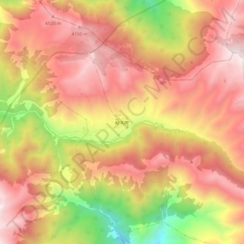
Name: Merag topographic map, elevation, terrain.
Location: Merag, Merag Toed, Merag Gewog, Trashigang District, Bhutan (27.26170 91.81802 27.34170 91.89802)
Average elevation: 3,676 m
Minimum elevation: 2,745 m
Maximum elevation: 4,316 m
Thank you for supporting this site ❤️
Make a donation
Make a donation
Gear up for your next adventure:
As an Amazon Associate, this site earns from qualifying purchases at no extra cost to you.