Geolocate

Totnes topographic map

Click on the map to display elevation.

About this map
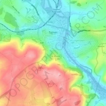
Name: Totnes topographic map, elevation, terrain.

Location: Totnes, Dartington, South Hams, Devon, Devon and Torbay, England, United Kingdom (50.41201 -3.71522 50.44066 -3.66777)

Average elevation: 66 m

Minimum elevation: -4 m

Maximum elevation: 156 m

Devon trails, hiking, mountain biking, running and outdoor activities

Other topographic maps

Click on a map to view its topography, its elevation and its terrain.

Week

United Kingdom > England > Devon > South Hams > Dartington

Average elevation: 49 m

Gear up for your next adventure:

🪓Outdoor Multitools - Versatile tools for hiking and camping
🥾Hiking Boots - Waterproof and durable boots for long-distance hiking in the UK
🔋Solar Chargers - Eco-friendly charging solutions for outdoor use
🗺️Topographic Maps - Detailed maps showing elevation and terrain features
🧥Packable Down Jackets - Lightweight warmth that compresses small in your bag

As an Amazon Associate, this site earns from qualifying purchases at no extra cost to you.