
Deal Island topographic map
Interactive map
Click on the map to display elevation.
About this map
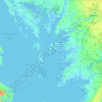
Name: Deal Island topographic map, elevation, terrain.
Location: Deal Island, Somerset County, Maryland, 21821, United States (37.82235 -76.26354 38.46235 -75.62354)
Average elevation: 2 m
Minimum elevation: -4 m
Maximum elevation: 32 m
Other topographic maps
Click on a map to view its topography, its elevation and its terrain.
Smith Island
United States > Maryland > Somerset County > Rhodes Point
Smith Island, Rhodes Point, Somerset County, Maryland, United States
Average elevation: 0 m
Jersey Island
United States > Maryland > Somerset County > Crisfield
Jersey Island, Crisfield, Somerset County, Maryland, 21817, United States
Average elevation: 2 m
Iverness
United States > Maryland > Somerset County
Iverness, Somerset County, Maryland, 21867, United States
Average elevation: -1 m
Crisfield
United States > Maryland > Somerset County
Crisfield, Somerset County, Maryland, 21817, United States
Average elevation: 1 m