Geolocate

Basra topographic map

Click on the map to display elevation.

About this map
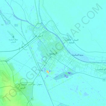
Name: Basra topographic map, elevation, terrain.

Location: Basra, Al-Basrah Central Subdistrict, Al-Basrah District, Basra Governorate, 00110, Iraq (30.33524 47.64910 30.65524 47.96910)

Average elevation: 4 m

Minimum elevation: -42 m

Maximum elevation: 69 m

Other topographic maps

Click on a map to view its topography, its elevation and its terrain.

Al-Basrah District

Iraq > Basra Governorate

Average elevation: 7 m

Safwan Subdistrict

Iraq > Basra Governorate

Average elevation: 55 m

Gear up for your next adventure:

🔦Head Torches - Hands-free lighting for hiking and camping
📷Camera Straps - Secure straps for carrying cameras while walking
🧺Mesh Stuff Sacks - Breathable storage for wet gear or camp organization
🎒Multi-day Trekking Packs - Large capacity backpacks for wild camping and long-distance trails
🧭Emergency Beacons - Safety beacons for remote outdoor locations

As an Amazon Associate, this site earns from qualifying purchases at no extra cost to you.