Geolocate

Tenby Point topographic map

Click on the map to display elevation.

About this map

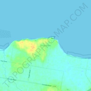
Name: Tenby Point topographic map, elevation, terrain.

Location: Tenby Point, Bass Coast Shire, Victoria, Australia (-38.43100 145.45715 -38.39100 145.49715)

Average elevation: 4 m

Minimum elevation: 0 m

Maximum elevation: 28 m

Gear up for your next adventure:

❄️Walking Crampons - Added traction for icy slopes and winter peak bagging
🐕Hiking Dog Harnesses - Rugged harnesses for taking your companion on mountain trails
🥾Hiking Boot Waterproofing Wax - Maintain the lifespan of your leather trekking boots
🔭Compact Hiking Binoculars - Lightweight optics for scouting terrain and spotting wildlife
🛌Insulated Sleeping Mats - Crucial thermal protection when sleeping on cold, uneven ground

As an Amazon Associate, this site earns from qualifying purchases at no extra cost to you.