
Thank you for supporting this site ❤️
Make a donation
Make a donation
Gear up for your next adventure:
As an Amazon Associate, this site earns from qualifying purchases at no extra cost to you.
Tenggiran topographic map
Click on the map to display elevation.
Thank you for supporting this site ❤️
Make a donation
Make a donation
Gear up for your next adventure:
As an Amazon Associate, this site earns from qualifying purchases at no extra cost to you.
About this map
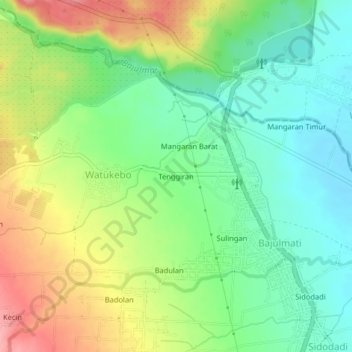
Name: Tenggiran topographic map, elevation, terrain.
Location: Tenggiran, Watukebo, Banyuwangi, East Java, Java, Indonesia (-7.95309 114.36050 -7.91309 114.40050)
Average elevation: 56 m
Minimum elevation: 13 m
Maximum elevation: 121 m
Thank you for supporting this site ❤️
Make a donation
Make a donation
Gear up for your next adventure:
As an Amazon Associate, this site earns from qualifying purchases at no extra cost to you.