
Silbury Hill topographic map
Interactive map
Click on the map to display elevation.
About this map
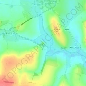
Name: Silbury Hill topographic map, elevation, terrain.
Average elevation: 166 m
Minimum elevation: 145 m
Maximum elevation: 205 m
Other topographic maps
Click on a map to view its topography, its elevation and its terrain.
Avebury Stone Circle
United Kingdom > England > Wiltshire > Beckhampton
Avebury Stone Circle, High Street, Avebury Trusloe, Beckhampton, Avebury, Wiltshire, England, SN8 1RF, United Kingdom
Average elevation: 165 m