
Thank you for supporting this site ❤️
Make a donation
Make a donation
Gear up for your next adventure:
As an Amazon Associate, this site earns from qualifying purchases at no extra cost to you.
Chilpi topographic map
Click on the map to display elevation.
Thank you for supporting this site ❤️
Make a donation
Make a donation
Gear up for your next adventure:
As an Amazon Associate, this site earns from qualifying purchases at no extra cost to you.
About this map
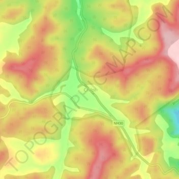
Name: Chilpi topographic map, elevation, terrain.
Location: Chilpi, Bodla Tahsil, Kabirdham District, Chhattisgarh, India (22.15218 81.03305 22.19218 81.07305)
Average elevation: 822 m
Minimum elevation: 705 m
Maximum elevation: 903 m
Thank you for supporting this site ❤️
Make a donation
Make a donation
Gear up for your next adventure:
As an Amazon Associate, this site earns from qualifying purchases at no extra cost to you.