Geolocate

Calamba topographic map

Click on the map to display elevation.

About this map

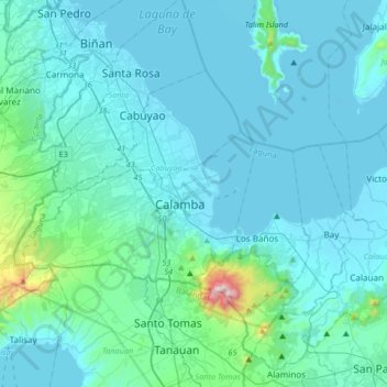
Name: Calamba topographic map, elevation, terrain.

Location: Calamba, Laguna, Calabarzon, 4027, Philippines (14.04602 120.99565 14.36602 121.31565)

Average elevation: 100 m

Minimum elevation: -3 m

Maximum elevation: 1,073 m

Gear up for your next adventure:

👕Technical Hiking Tees - Moisture-management for high-exertion climbs
🛑Emergency Bivvy Bags - Heat-reflective survival bags for unexpected nights out
🧭GPS Trackers - Tracking devices for safety and navigation
🥾Women's Waterproof Hiking Boots - High-performance trekking boots designed for all-weather comfort
🎿Telescopic Trekking Poles - Reduces knee strain on steep topographic descents

As an Amazon Associate, this site earns from qualifying purchases at no extra cost to you.