Geolocate

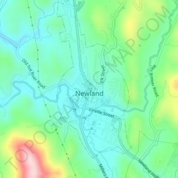
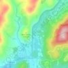
Newland topographic map

Click on the map to display elevation.

Newland

At an elevation of 3,621 feet or 1,104 metres, it is the highest county seat in the Eastern United States (based on elevations in the USGS database).

Wikipedia (CC-BY-SA 3.0)

About this map

Name: Newland topographic map, elevation, terrain.

Location: Newland, Avery County, North Carolina, United States (36.07748 -81.93346 36.10475 -81.91943)

Average elevation: 1,140 m

Minimum elevation: 1,074 m

Maximum elevation: 1,321 m

Other topographic maps

Click on a map to view its topography, its elevation and its terrain.
Pineola

United States > North Carolina > Avery County

Average elevation: 1,107 m

Flat Springs

United States > North Carolina > Avery County

Average elevation: 1,017 m

Linville

United States > North Carolina > Avery County

Average elevation: 1,184 m

Cranberry

United States > North Carolina > Avery County

Average elevation: 1,088 m

Linville

United States > North Carolina > Avery County

Average elevation: 1,184 m

Linville

United States > North Carolina > Avery County

Average elevation: 1,184 m

Linville

United States > North Carolina > Avery County

Average elevation: 1,184 m

Valley

United States > North Carolina > Avery County

Average elevation: 1,265 m

Pineola

United States > North Carolina > Avery County

Average elevation: 1,107 m

Plumtree

United States > North Carolina > Avery County

Average elevation: 1,008 m

Beech Mountain

United States > North Carolina > Avery County > Beech Mountain

Beech Mountain is a mountain in the North Carolina High Country and wholly in the Pisgah National Forest. Its elevation reaches 5,506 feet (1,657 m) and generates feeder streams for the Elk River. Nestled on the top is the Town of Beech Mountain.

Average elevation: 1,433 m
Linville

United States > North Carolina > Avery County

Average elevation: 1,184 m

Gear up for your next adventure:

🔦LED Camping Lanterns - Illumination for reading maps inside your tent at night
📸Action Camera Chest Mounts - Record your ascent following topographic paths hands-free
🔋Power Banks - Portable chargers for long outdoor trips
🗺️Ordnance Survey Maps - Official UK maps for walking and outdoor activities
🔋Lithium AA Batteries - Long-lasting power that performs well in cold mountain weather

As an Amazon Associate, this site earns from qualifying purchases at no extra cost to you.