Geolocate

Normangee topographic map

Click on the map to display elevation.

About this map
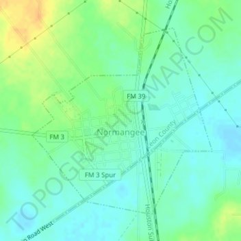
Name: Normangee topographic map, elevation, terrain.

Location: Normangee, Leon County, Texas, United States (31.02049 -96.12860 31.04135 -96.10502)

Average elevation: 118 m

Minimum elevation: 107 m

Maximum elevation: 137 m

Other topographic maps

Click on a map to view its topography, its elevation and its terrain.

Hilltop Lakes

United States > Texas > Leon County

Average elevation: 137 m

Keechi

United States > Texas > Leon County

Average elevation: 102 m

Gear up for your next adventure:

🐕Dog Hiking Gear - Equipment for hiking safely with dogs
🎒Hiking Daypacks - Compact backpacks ideal for short hikes and excursions
🥾Men's Waterproof Hiking Boots - Durable footwear with deep lugs for muddy and rocky UK terrains
📱Rugged Phone Cases - Heavy-duty protection for smartphones used as secondary GPS tools
🧷Tenacious Repair Tape - Instant fix for torn tents, jackets, or dry bags

As an Amazon Associate, this site earns from qualifying purchases at no extra cost to you.