
West Carleton topographic map
Interactive map
Click on the map to display elevation.
About this map
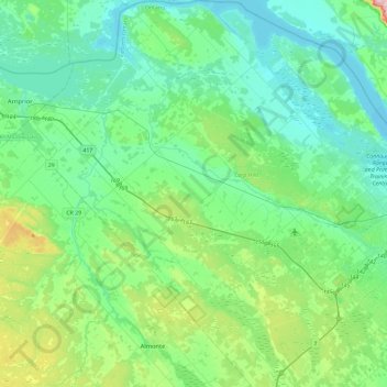
Name: West Carleton topographic map, elevation, terrain.
Location: West Carleton, Ottawa, Eastern Ontario, Ontario, Canada (45.19155 -76.35559 45.51874 -75.92036)
Average elevation: 111 m
Minimum elevation: 53 m
Maximum elevation: 345 m