
Dent Blanche topographic map
Interactive map
Click on the map to display elevation.
About this map
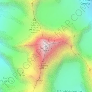
Name: Dent Blanche topographic map, elevation, terrain.
Location: Dent Blanche, Evolène, Hérens, Wallis, 1983, Switzerland (46.03413 7.61188 46.03423 7.61198)
Average elevation: 3,458 m
Minimum elevation: 2,923 m
Maximum elevation: 4,350 m
Other topographic maps
Click on a map to view its topography, its elevation and its terrain.
Pigne d'Arolla
Switzerland > Wallis > Hérens > Evolène
Pigne d'Arolla, Evolène, Hérens, Wallis, 1983, Switzerland
Average elevation: 3,280 m
Aiguilles Rouges d'Arolla
Switzerland > Wallis > Hérens > Evolène
Aiguilles Rouges d'Arolla, Evolène, Hérens, Wallis, 1983, Switzerland
Average elevation: 3,091 m