
Thank you for supporting this site ❤️
Make a donation
Make a donation
Gear up for your next adventure:
As an Amazon Associate, this site earns from qualifying purchases at no extra cost to you.
Pratapgad topographic map
Click on the map to display elevation.
Thank you for supporting this site ❤️
Make a donation
Make a donation
Gear up for your next adventure:
As an Amazon Associate, this site earns from qualifying purchases at no extra cost to you.
About this map
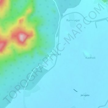
Name: Pratapgad topographic map, elevation, terrain.
Location: Pratapgad, Arjuni Morgaon Taluka, Gondiya, Maharashtra, India (20.77095 80.10216 20.81095 80.14216)
Average elevation: 273 m
Minimum elevation: 234 m
Maximum elevation: 535 m
Thank you for supporting this site ❤️
Make a donation
Make a donation
Gear up for your next adventure:
As an Amazon Associate, this site earns from qualifying purchases at no extra cost to you.