
Frauenfeld topographic map
Interactive map
Click on the map to display elevation.
About this map
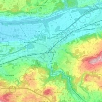
Name: Frauenfeld topographic map, elevation, terrain.
Location: Frauenfeld, Bezirk Frauenfeld, Thurgau, Switzerland (47.52703 8.83774 47.58656 8.94582)
Average elevation: 459 m
Minimum elevation: 379 m
Maximum elevation: 652 m