Sogod topographic map
Click on the map to display elevation.
Sogod
On May 18, 1700, the colonial government of the Philippines established Sogod as a regular visita [satellite barrio with chapel]. With this elevation, a concrete church finally stood in the settlement in the year 1718. The construction was made possible through the mandate of the Most Reverend Sebastian Foronda, OSA, bishopric of Cebu. Eventually, more subdistricts in the vicinity of Sogod came into existence such as the barrio of Maak, which was established on February 3, 1730 while the barrio of Buntuk was erected on April 10, 1750.
About this map
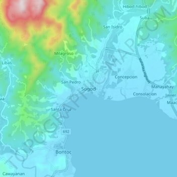
Name: Sogod topographic map, elevation, terrain.
Location: Sogod, Southern Leyte, Eastern Visayas, 6606, Philippines (10.34459 124.94080 10.42459 125.02080)
Average elevation: 94 m
Minimum elevation: 0 m
Maximum elevation: 787 m
Other topographic maps
Click on a map to view its topography, its elevation and its terrain.

Limasawa
Limasawa was the second island (after Suluan) of the Philippines that the Magellan Expedition landed on. Antonio Pigafetta documented the island as "Mazaua". He described it as being inhabited with cultivated fields. In March 28, 1521 the Magellan Expedition met with two rulers, Rajah Colambu and Rahah Siaui,…
Average elevation: 1 m