
Bauma topographic map
Interactive map
Click on the map to display elevation.
About this map
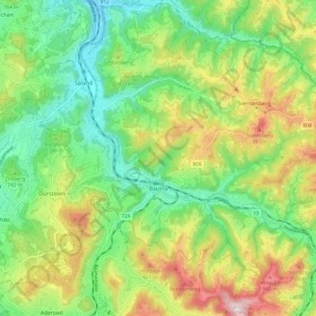
Name: Bauma topographic map, elevation, terrain.
Location: Bauma, Bezirk Pfäffikon, Zurich, Switzerland (47.34751 8.83806 47.40172 8.94371)
Average elevation: 756 m
Minimum elevation: 580 m
Maximum elevation: 1,050 m
Other topographic maps
Click on a map to view its topography, its elevation and its terrain.
Bliggenswil
Switzerland > Zurich > Bezirk Pfäffikon > Bauma > Bliggenswil
Bliggenswil, Bauma, Bezirk Pfäffikon, Zurich, 8494, Switzerland
Average elevation: 755 m
Weisslingen
Switzerland > Zurich > Bezirk Pfäffikon
Weisslingen, Bezirk Pfäffikon, Zurich, Switzerland
Average elevation: 624 m