
Thank you for supporting this site ❤️
Make a donation
Make a donation
Gear up for your next adventure:
As an Amazon Associate, this site earns from qualifying purchases at no extra cost to you.
Montejaque topographic map
Click on the map to display elevation.
Thank you for supporting this site ❤️
Make a donation
Make a donation
Gear up for your next adventure:
As an Amazon Associate, this site earns from qualifying purchases at no extra cost to you.
About this map
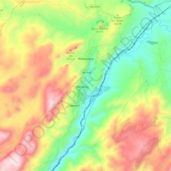
Name: Montejaque topographic map, elevation, terrain.
Location: Montejaque, Serranía de Ronda, Malaga, Andalusia, 29360, Spain (36.67334 -5.33040 36.76528 -5.22718)
Average elevation: 801 m
Minimum elevation: 397 m
Maximum elevation: 1,308 m
Thank you for supporting this site ❤️
Make a donation
Make a donation
Gear up for your next adventure:
As an Amazon Associate, this site earns from qualifying purchases at no extra cost to you.