Geolocate

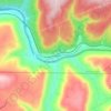
New Hope topographic map

Click on the map to display elevation.

About this map
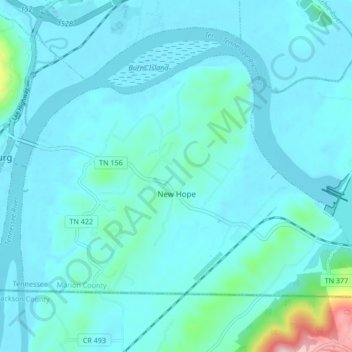
Name: New Hope topographic map, elevation, terrain.

Location: New Hope, Marion County, East Tennessee, Tennessee, 37580, United States (34.98484 -85.69575 35.03226 -85.61149)

Average elevation: 211 m

Minimum elevation: 178 m

Maximum elevation: 500 m

Other topographic maps

Click on a map to view its topography, its elevation and its terrain.
Deadman Eddy

United States > Tennessee > Marion County

Average elevation: 355 m

Haletown

United States > Tennessee > Marion County > Ladds

Average elevation: 286 m

Whiteside

United States > Tennessee > Marion County

Average elevation: 368 m

Sequatchie

United States > Tennessee > Marion County

Average elevation: 260 m

Shake Rag

United States > Tennessee > Marion County

Average elevation: 343 m

Ladds

United States > Tennessee > Marion County

Average elevation: 291 m

Haletown

United States > Tennessee > Marion County

Average elevation: 286 m

Pinhook

United States > Tennessee > Marion County

Average elevation: 304 m

Gear up for your next adventure:

🗺️Topographic Maps - Detailed maps showing elevation and terrain features
🌦️Portable Weather Meters - Handheld tools for monitoring weather conditions
🧰Survival Kits - Emergency tools for remote environments
🧗Locking Carabiners - Secure gear to your pack or for light technical use
⛺Lightweight Solo Tents - Backpacking tents designed for wild camping in the UK highlands

As an Amazon Associate, this site earns from qualifying purchases at no extra cost to you.