
Make a donation
Gear up for your next adventure:
As an Amazon Associate, this site earns from qualifying purchases at no extra cost to you.
Hayling Island topographic map
Click on the map to display elevation.
Make a donation
Gear up for your next adventure:
As an Amazon Associate, this site earns from qualifying purchases at no extra cost to you.
Hayling Island
An Iron Age shrine in the north of Hayling Island was later developed into a Roman temple in the 1st century BC and was first recorded in Richard Scott's Topographical and Historical Account of Hayling Island (1826). The site was dug between 1897 and 1907 and again from 1976 to 1978. The remains are now buried under farmland. The first coin credited to Commius that was found in an archaeological dig was found at the temple. This Commius was probably the son of the Commius mentioned by Julius Caesar, although it is possible the coin was issued by the same Commius.
Make a donation
Gear up for your next adventure:
As an Amazon Associate, this site earns from qualifying purchases at no extra cost to you.
About this map
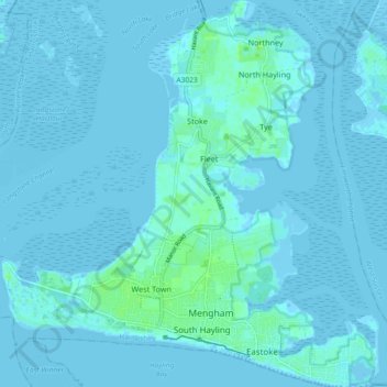
Name: Hayling Island topographic map, elevation, terrain.
Average elevation: 1 m
Minimum elevation: -4 m
Maximum elevation: 10 m
Hampshire trails, hiking, mountain biking, running and outdoor activities
Make a donation
Gear up for your next adventure:
As an Amazon Associate, this site earns from qualifying purchases at no extra cost to you.