Geolocate

Buffalo topographic map

Click on the map to display elevation.

About this map
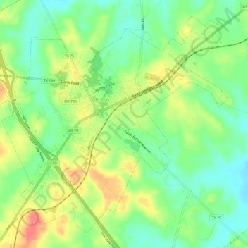
Name: Buffalo topographic map, elevation, terrain.

Location: Buffalo, Leon County, Texas, 75831, United States (31.43692 -96.09287 31.48034 -96.03481)

Average elevation: 109 m

Minimum elevation: 82 m

Maximum elevation: 145 m

Other topographic maps

Click on a map to view its topography, its elevation and its terrain.

Hilltop Lakes

United States > Texas > Leon County

Average elevation: 137 m

Keechi

United States > Texas > Leon County

Average elevation: 102 m

Gear up for your next adventure:

📷Camera Straps - Secure straps for carrying cameras while walking
🌄Compact Monoculars - Lightweight optics for hiking
🎒Hiking Daypacks (20L) - Compact backpacks for day trips and technical mountain ascents
🎒Replacement Sternum Straps - Repair parts for hiking rucksacks
🍲Portable Camping Stoves - Fast-boiling stoves for hot meals on remote topographic survey trips

As an Amazon Associate, this site earns from qualifying purchases at no extra cost to you.