Geolocate

Ostfildern topographic map

Click on the map to display elevation.

About this map
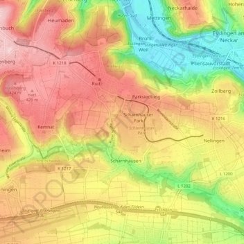
Name: Ostfildern topographic map, elevation, terrain.

Location: Ostfildern, Landkreis Esslingen, Baden-Württemberg, 73760, Germany (48.69467 9.21151 48.74430 9.31194)

Average elevation: 350 m

Minimum elevation: 226 m

Maximum elevation: 454 m

Other topographic maps

Click on a map to view its topography, its elevation and its terrain.

Gear up for your next adventure:

🧼Technical Clothing Wash - Special soap to clean and restore waterproof membranes
🧭Professional Hiking Compasses - High-precision liquid-filled compasses for map reading and orientation
❄️Walking Crampons - Added traction for icy slopes and winter peak bagging
🥼Base Layers - Thermal base layers for temperature regulation
🎒Hiking Daypacks - Compact backpacks ideal for short hikes and excursions

As an Amazon Associate, this site earns from qualifying purchases at no extra cost to you.