
Ruiselede topographic map
Interactive map
Click on the map to display elevation.
About this map
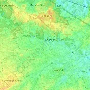
Name: Ruiselede topographic map, elevation, terrain.
Location: Ruiselede, Tielt, West Flanders, 8755, Belgium (51.02408 3.32690 51.10096 3.44600)
Average elevation: 17 m
Minimum elevation: 7 m
Maximum elevation: 31 m