

Caracas topographic map
Click on the map to display elevation.
Caracas
Caracas is contained entirely within a valley of the Venezuelan Central Range, and is separated from the Caribbean coast by a roughly 15-kilometer (9 mi) expanse of El Ávila National Park. The valley is relatively small and quite irregular, and the altitude varies from between 870 and 1,043 meters (2,854 and 3,422 ft) above sea level; the historic center lies at about 900 meters (3,000 feet) above sea level. This, along with the rapid population growth, has profoundly influenced the urban development of the city. The most elevated point of the Capital District, wherein the city is located, is the Pico El Ávila, which rises to 2,159 meters (7,083 feet).
About this map
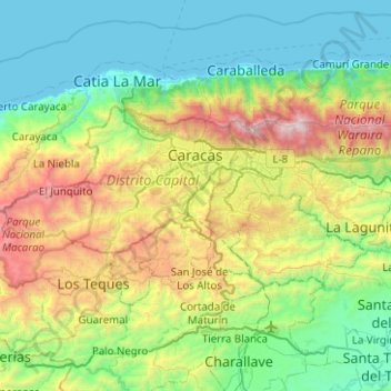
Name: Caracas topographic map, elevation, terrain.
Average elevation: 759 m
Minimum elevation: -1 m
Maximum elevation: 2,728 m