Geolocate

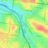
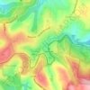
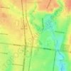
Launching Place topographic map

Click on the map to display elevation.

About this map

Name: Launching Place topographic map, elevation, terrain.

Location: Launching Place, Melbourne, Shire of Yarra Ranges, Victoria, 3139, Australia (-37.82457 145.53246 -37.73747 145.62283)

Average elevation: 162 m

Minimum elevation: 79 m

Maximum elevation: 612 m

Other topographic maps

Click on a map to view its topography, its elevation and its terrain.
Mount Disappointment

Australia > Victoria > Melbourne

Average elevation: 706 m

Dights Falls

Australia > Victoria > Melbourne

Average elevation: 28 m

Shire Hall Beach

Australia > Victoria > Melbourne

Average elevation: 15 m

Mount Cottrell

Australia > Victoria > Melbourne

Average elevation: 143 m

Ridoutt Island

Australia > Victoria > Melbourne

Average elevation: 17 m

Gardiners Creek

Australia > Victoria > Melbourne > Malvern East

Average elevation: 37 m

Strathmore

Australia > Victoria > Melbourne > Strathmore

Average elevation: 62 m

Malvern East

Australia > Victoria > Melbourne > Malvern East

Average elevation: 52 m

Parkdale Beach

Australia > Victoria > Melbourne

Average elevation: 10 m

Cranbourne East

Australia > Victoria > Melbourne

Average elevation: 44 m

Heatherton

Australia > Victoria > Melbourne > Heatherton

Average elevation: 37 m

Kew East

Australia > Victoria > Melbourne > Kew East

Average elevation: 48 m

Eight Hour Reserve

Australia > Victoria > Melbourne

Average elevation: 34 m

Emerald Lake

Australia > Victoria > Melbourne

Average elevation: 274 m

CERES Environment Park

Australia > Victoria > Melbourne

Average elevation: 47 m

Larnoo Drive Reserve

Australia > Victoria > Melbourne

Average elevation: 69 m

Gunnamatta Beach

Australia > Victoria > Melbourne > Cape Schanck

Average elevation: 13 m

Shepherds Bush

Australia > Victoria > Melbourne

Average elevation: 76 m

Castle Hill Reserve

Australia > Victoria > Melbourne

Average elevation: 136 m

Gladstone Park

Australia > Victoria > Melbourne > Gladstone Park

Average elevation: 101 m

Corkscrew Hill

Australia > Victoria > Melbourne

Average elevation: 78 m

Ardeer

Australia > Victoria > Melbourne > Ardeer

Average elevation: 49 m

Pentridge Piazza

Australia > Victoria > Melbourne

Average elevation: 61 m

Roy Hill

Australia > Victoria > Melbourne

Average elevation: 761 m

Mavis Hutter Reserve

Australia > Victoria > Melbourne

Average elevation: 47 m

Ashwood

Australia > Victoria > Melbourne > Ashwood

Average elevation: 76 m

Ardrie Park

Australia > Victoria > Melbourne > Malvern East

Average elevation: 46 m

Caulfield East

Australia > Victoria > Melbourne > Caulfield East

Average elevation: 40 m

Cairnlea

Australia > Victoria > Melbourne > Cairnlea

Average elevation: 61 m

McConchie Reserve

Australia > Victoria > Melbourne

Average elevation: 20 m

Gear up for your next adventure:

🕶️Glacier Goggles - Maximum protection for high-altitude snow topography
💧Hydration Reservoirs - Convenient water bladders for hands-free drinking on the move
⛺Lightweight Tents - Compact tents for backpacking and trekking
⌚Altimeter Watches - Watches measuring altitude for mountain activities
🧴Tick Removal Tools - Small, essential health tool for UK woodland and moorland

As an Amazon Associate, this site earns from qualifying purchases at no extra cost to you.