
Thank you for supporting this site ❤️
Make a donation
Make a donation
Gear up for your next adventure:
As an Amazon Associate, this site earns from qualifying purchases at no extra cost to you.
Caniles topographic map
Click on the map to display elevation.
Thank you for supporting this site ❤️
Make a donation
Make a donation
Gear up for your next adventure:
As an Amazon Associate, this site earns from qualifying purchases at no extra cost to you.
About this map
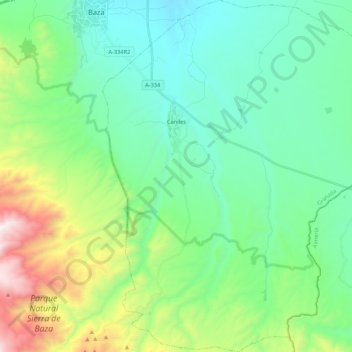
Name: Caniles topographic map, elevation, terrain.
Location: Caniles, Comarca de Baza, Granada, Andalusia, 18810, Spain (37.32525 -2.76713 37.49474 -2.57121)
Average elevation: 1,121 m
Minimum elevation: 770 m
Maximum elevation: 2,184 m
Thank you for supporting this site ❤️
Make a donation
Make a donation
Gear up for your next adventure:
As an Amazon Associate, this site earns from qualifying purchases at no extra cost to you.