Geolocate

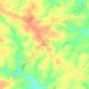
Carthage topographic map

Click on the map to display elevation.

About this map
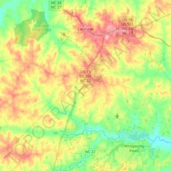
Name: Carthage topographic map, elevation, terrain.

Location: Carthage, Moore County, North Carolina, United States (35.23855 -79.44226 35.36723 -79.34362)

Average elevation: 128 m

Minimum elevation: 80 m

Maximum elevation: 181 m

Other topographic maps

Click on a map to view its topography, its elevation and its terrain.
Westmoore

United States > North Carolina > Moore County

Average elevation: 163 m

Lakeview

United States > North Carolina > Moore County

Average elevation: 89 m

Sandhill

United States > North Carolina > Moore County > Foxfire

Average elevation: 139 m

Gear up for your next adventure:

🥼Base Layers - Thermal base layers for temperature regulation
🎒Replacement Sternum Straps - Repair parts for hiking rucksacks
📕Outdoor Navigation Books - Learn traditional and modern navigation techniques
🔥Emergency Fire Starters - Reliable ignition tools for survival situations in damp conditions
🧘Folding Sit Mats - Dry and warm seat for map-reading breaks on damp ground

As an Amazon Associate, this site earns from qualifying purchases at no extra cost to you.