
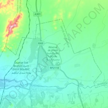
Ouahat Sidi Brahim topographic map
Interactive map
Click on the map to display elevation.
About this map
Name: Ouahat Sidi Brahim topographic map, elevation, terrain.
Average elevation: 451 m
Minimum elevation: 389 m
Maximum elevation: 748 m
Other topographic maps
Click on a map to view its topography, its elevation and its terrain.
Al Ouidane
Al Ouidane, caïdat d'Al Ouidane, cercle d'Al Ouidane, Marrakesh Prefecture, Marrakech-Safi, Morocco
Average elevation: 503 m