Geolocate

Mesra topographic map

Click on the map to display elevation.

About this map
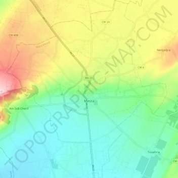
Name: Mesra topographic map, elevation, terrain.

Location: Mesra, Mesra District, Mostaganem, 27000, Algeria (35.79706 0.11632 35.88977 0.21941)

Average elevation: 138 m

Minimum elevation: 38 m

Maximum elevation: 324 m

Other topographic maps

Click on a map to view its topography, its elevation and its terrain.

Mansourah

Algeria > Mostaganem > Mesra District > Mansourah

Average elevation: 153 m

Gear up for your next adventure:

🦟Anti-Midge & Tick Repellent - Vital for hiking in the Scottish Highlands during summer
🧥Packable Down Jackets - Lightweight warmth that compresses small in your bag
👖Hiking Trousers - Durable trousers designed for rough terrain
👕Technical Hiking Tees - Moisture-management for high-exertion climbs
📦Compression Sacks - Reduce backpack volume efficiently

As an Amazon Associate, this site earns from qualifying purchases at no extra cost to you.