
Watkins Glen topographic map
Interactive map
Click on the map to display elevation.
About this map
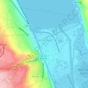
Name: Watkins Glen topographic map, elevation, terrain.
Average elevation: 179 m
Minimum elevation: 133 m
Maximum elevation: 317 m
Other topographic maps
Click on a map to view its topography, its elevation and its terrain.
Lamoka Lake
United States > New York > Schuyler County > Town of Tyrone > Weston
Lamoka Lake, Weston, Town of Tyrone, Schuyler County, New York, United States
Average elevation: 351 m
Mecklenburg
United States > New York > Schuyler County > Mecklenburg
Mecklenburg, Schuyler County, New York, 14863, United States
Average elevation: 395 m