Geolocate

Eustace topographic map

Click on the map to display elevation.

About this map

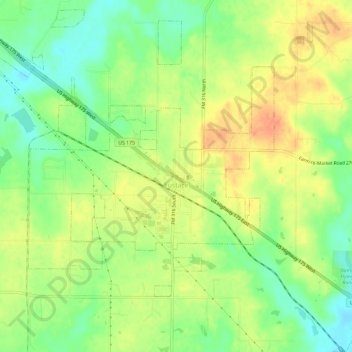
Name: Eustace topographic map, elevation, terrain.

Location: Eustace, Henderson County, Texas, United States (32.28498 -96.04250 32.33177 -95.98394)

Average elevation: 125 m

Minimum elevation: 103 m

Maximum elevation: 146 m

Other topographic maps

Click on a map to view its topography, its elevation and its terrain.

Trinity River

United States > Texas > Henderson County > Tool

Average elevation: 92 m

Murchison

United States > Texas > Henderson County

Average elevation: 146 m

Gear up for your next adventure:

🧣Neck Gaiters - Versatile protection against wind and cold
🦯Walking Poles - Supportive poles for long-distance walking
🚲Cycling GPS Computers - Track elevation and topographic routes on two wheels
🦶Anti-Blister Balms - Protect your feet before long topographic expeditions
🥤Collapsible Water Bottles - Save space in your rucksack as you consume your water

As an Amazon Associate, this site earns from qualifying purchases at no extra cost to you.